Weather Alert in Wisconsin
Flood Watch issued April 3 at 9:48PM CDT until April 8 at 1:00AM CDT by NWS Milwaukee/Sullivan WI
AREAS AFFECTED: Columbia, WI; Sauk, WI
DESCRIPTION: ...The National Weather Service in Milwaukee/Sullivan WI has issued a Flood Watch for the following rivers in Wisconsin... Baraboo River At Reedsburg affecting Sauk County. Baraboo River At Rock Springs affecting Sauk County. Baraboo River Near Baraboo affecting Columbia and Sauk Counties. * WHAT...Flooding is possible. * WHERE...Baraboo River near Baraboo. * WHEN...From Sunday afternoon to early Wednesday morning. * IMPACTS...At 18.0 feet, If Wisconsin River at Portage up to 17 feet also, water approaches gravel of I-39 off ramp to Cascade Mt Rd. There is widespread flooding of agricultural land. * ADDITIONAL DETAILS... - At 9:00 PM CDT Friday the stage was 12.2 feet. - Forecast...Flood stage may be reached early Sunday afternoon. - Flood stage is 16.0 feet. - http://www.weather.gov/safety/flood
INSTRUCTION: If you are in the watch area, remain alert to possible flooding. Additional information is available at www.weather.gov. The next statement will be issued Saturday morning at 600 AM CDT.
Want more detail? Get the Complete 7 Day and Night Detailed Forecast!
Current U.S. National Radar--Current
The Current National Weather Radar is shown below with a UTC Time (subtract 5 hours from UTC to get Eastern Time).

National Weather Forecast--Current
The Current National Weather Forecast and National Weather Map are shown below.

National Weather Forecast for Tomorrow
Tomorrow National Weather Forecast and Tomorrow National Weather Map are show below.

North America Water Vapor (Moisture)
This map shows recent moisture content over North America. Bright and colored areas show high moisture (ie, clouds); brown indicates very little moisture present; black indicates no moisture.

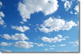
Weather Topic: What are Cumulonimbus Clouds?
Home - Education - Cloud Types - Cumulonimbus Clouds
 Next Topic: Cumulus Clouds
The final form taken by a growing cumulus cloud is the
cumulonimbus cloud, which is very tall and dense.
The tower of a cumulonimbus cloud can soar 23 km into the atmosphere, although
most commonly they stop growing at an altitude of 6 km.
Even small cumulonimbus clouds appear very large in comparison to other cloud types.
They can signal the approach of stormy weather, such as thunderstorms or blizzards.
Next Topic: Cumulus Clouds
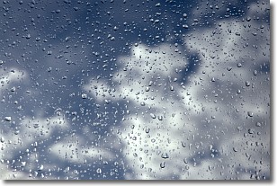
Weather Topic: What is Drizzle?
Home - Education - Precipitation - Drizzle
 Next Topic: Evaporation
Drizzle is precipitation in the form of water droplets which are
smaller than raindrops.
Drizzle is characterized by fine, gently falling droplets and typically does not
impact human habitation in a negative way. The exception to this is freezing drizzle,
a condition where drizzle freezes immediately upon reaching earth's surface.
Freezing drizzle is still less dangerous than freezing rain, but can
potentially result in hazardous road conditions.
Next Topic: Evaporation
Current conditions powered by WeatherAPI.com


