Weather Alert in District of Columbia
Extreme Heat Warning issued June 24 at 4:46AM EDT until June 24 at 9:00PM EDT by NWS Baltimore MD/Washington DC
AREAS AFFECTED: District of Columbia; Frederick; Carroll; Northern Baltimore; Cecil; Southern Baltimore; Prince Georges; Anne Arundel; Charles; St. Marys; Calvert; Northwest Montgomery; Central and Southeast Montgomery; Northwest Howard; Central and Southeast Howard; Northwest Harford; Southeast Harford; Nelson; Albemarle; Greene; Madison; Rappahannock; Orange; Culpeper; Fairfax; Arlington/Falls Church/Alexandria; Stafford; Spotsylvania; King George; Northern Fauquier; Southern Fauquier; Western Loudoun; Eastern Loudoun; Northwest Prince William; Central and Southeast Prince William/Manassas/Manassas Park
DESCRIPTION: * WHAT...For the Extreme Heat Warning, dangerously hot conditions with heat index values up to 111 expected. For the Extreme Heat Watch, dangerously hot conditions with heat index values up to 110 possible. * WHERE...DC, central, north central, northeast, northern, and southern Maryland, and central, northern, and northwest Virginia. * WHEN...For the Extreme Heat Warning, from 11 AM this morning to 9 PM EDT this evening. For the Extreme Heat Watch, from Wednesday morning through Wednesday evening. * IMPACTS...Heat related illnesses increase significantly during extreme heat and high humidity events.
INSTRUCTION: Drink plenty of fluids, stay in an air-conditioned room, stay out of the sun, and check up on relatives and neighbors.
Want more detail? Get the Complete 7 Day and Night Detailed Forecast!
Current U.S. National Radar--Current
The Current National Weather Radar is shown below with a UTC Time (subtract 5 hours from UTC to get Eastern Time).

National Weather Forecast--Current
The Current National Weather Forecast and National Weather Map are shown below.

National Weather Forecast for Tomorrow
Tomorrow National Weather Forecast and Tomorrow National Weather Map are show below.

North America Water Vapor (Moisture)
This map shows recent moisture content over North America. Bright and colored areas show high moisture (ie, clouds); brown indicates very little moisture present; black indicates no moisture.

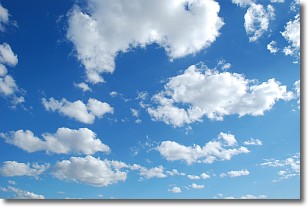
Weather Topic: What are Cumulonimbus Clouds?
Home - Education - Cloud Types - Cumulonimbus Clouds
 Next Topic: Cumulus Clouds
The final form taken by a growing cumulus cloud is the
cumulonimbus cloud, which is very tall and dense.
The tower of a cumulonimbus cloud can soar 23 km into the atmosphere, although
most commonly they stop growing at an altitude of 6 km.
Even small cumulonimbus clouds appear very large in comparison to other cloud types.
They can signal the approach of stormy weather, such as thunderstorms or blizzards.
Next Topic: Cumulus Clouds
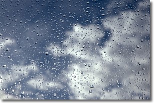
Weather Topic: What is Drizzle?
Home - Education - Precipitation - Drizzle
 Next Topic: Evaporation
Drizzle is precipitation in the form of water droplets which are
smaller than raindrops.
Drizzle is characterized by fine, gently falling droplets and typically does not
impact human habitation in a negative way. The exception to this is freezing drizzle,
a condition where drizzle freezes immediately upon reaching earth's surface.
Freezing drizzle is still less dangerous than freezing rain, but can
potentially result in hazardous road conditions.
Next Topic: Evaporation
Current conditions powered by WeatherAPI.com


