Weather Alerts for Colorado
1. Freeze Warning for: Grand Valley; Arches/Grand Flat; Canyonlands/Natural Bridges
2. Freeze Warning for: Lower Yampa River Basin; Debeque to Silt Corridor; Central Colorado River Basin; Central Gunnison and Uncompahgre River Basin; Paradox Valley/Lower Dolores River; Four Corners/Upper Dolores River; Animas River Basin; San Juan River Basin; Eastern Uinta Basin
3. Freeze Watch for: Lower Yampa River Basin; Debeque to Silt Corridor; Central Colorado River Basin; Central Gunnison and Uncompahgre River Basin; Paradox Valley/Lower Dolores River; Four Corners/Upper Dolores River; Animas River Basin; San Juan River Basin; Eastern Uinta Basin
4. Red Flag Warning for: Fremont County Including Canon City/Howard/Texas Creek; San Luis Valley Including Alamosa/Del Norte/Fort Garland/Saguache; Northern El Paso County Including Monument and Black Forest; Southern El Paso County Including Fort Carson and Colorado Springs; Pueblo County Including Pueblo; Huerfano County Including Walsenburg; Western Las Animas County Including Trinidad and Thatcher; Crowley County Including Ordway; Otero County Including La Junta and Western Comanche Grasslands; Eastern Las Animas County Including Pinon Canyon; Kiowa County Including Eads; Bent County Including Las Animas; Prowers County Including Lamar; Baca County Including Springfield and Eastern Comanche Grasslands
5. Red Flag Warning for: Larimer County Below 6000 Feet/Northwest Weld County; Boulder And Jefferson Counties Below 6000 Feet/West Broomfield County; North Douglas County Below 6000 Feet/Denver/West Adams and Arapahoe Counties/East Broomfield County; Elbert/Central and East Douglas Counties Above 6000 Feet; Northeast Weld County; Central and South Weld County; Morgan County; Central and East Adams and Arapahoe Counties; North and Northeast Elbert County Below 6000 Feet/North Lincoln County; Southeast Elbert County Below 6000 Feet/South Lincoln County; Logan County; Washington County; Sedgwick County; Phillips County
6. Red Flag Warning for: Yuma; Kit Carson County; Cheyenne; Cheyenne; Rawlins; Decatur; Norton; Sherman; Thomas; Sheridan; Graham; Wallace; Logan; Gove; Greeley; Wichita; Dundy; Hitchcock; Red Willow
Want more detail? Get the Complete 7 Day and Night Detailed Forecast!
Current U.S. National Radar--Current
The Current National Weather Radar is shown below with a UTC Time (subtract 5 hours from UTC to get Eastern Time).

National Weather Forecast--Current
The Current National Weather Forecast and National Weather Map are shown below.

National Weather Forecast for Tomorrow
Tomorrow National Weather Forecast and Tomorrow National Weather Map are show below.

North America Water Vapor (Moisture)
This map shows recent moisture content over North America. Bright and colored areas show high moisture (ie, clouds); brown indicates very little moisture present; black indicates no moisture.

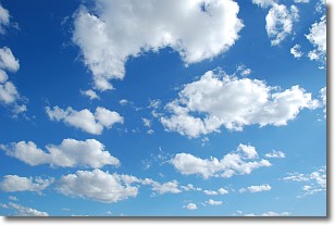
Weather Topic: What are Cumulonimbus Clouds?
Home - Education - Cloud Types - Cumulonimbus Clouds
 Next Topic: Cumulus Clouds
The final form taken by a growing cumulus cloud is the
cumulonimbus cloud, which is very tall and dense.
The tower of a cumulonimbus cloud can soar 23 km into the atmosphere, although
most commonly they stop growing at an altitude of 6 km.
Even small cumulonimbus clouds appear very large in comparison to other cloud types.
They can signal the approach of stormy weather, such as thunderstorms or blizzards.
Next Topic: Cumulus Clouds
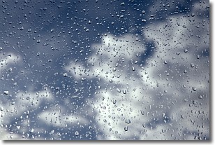
Weather Topic: What is Drizzle?
Home - Education - Precipitation - Drizzle
 Next Topic: Evaporation
Drizzle is precipitation in the form of water droplets which are
smaller than raindrops.
Drizzle is characterized by fine, gently falling droplets and typically does not
impact human habitation in a negative way. The exception to this is freezing drizzle,
a condition where drizzle freezes immediately upon reaching earth's surface.
Freezing drizzle is still less dangerous than freezing rain, but can
potentially result in hazardous road conditions.
Next Topic: Evaporation
Current conditions powered by WeatherAPI.com


